blah blah blah
Wantastiquet Mountain
Length: 3.7 miles out-and-backDifficulty (click for info): Easy
Elevation Gain: 900 feet
Rating (click for info): 6/10
Elevation: 1368'
Prominence: 650'
Driving Directions:
Trailhead is on Gulf Road in Chesterfield, NH. To get there, take Stage Road from Rt. 63, 1.6 miles south of Rt. 9. Drive 0.2 miles and bear left onto Castle Road. Continue 1 mile to where Castle Road ends at Gulf Road. Turn left and follow Gulf Road 1.9 miles to the parking area on the left, which is marked with a Forest Society Sign.
Trail Map
About the Hike:
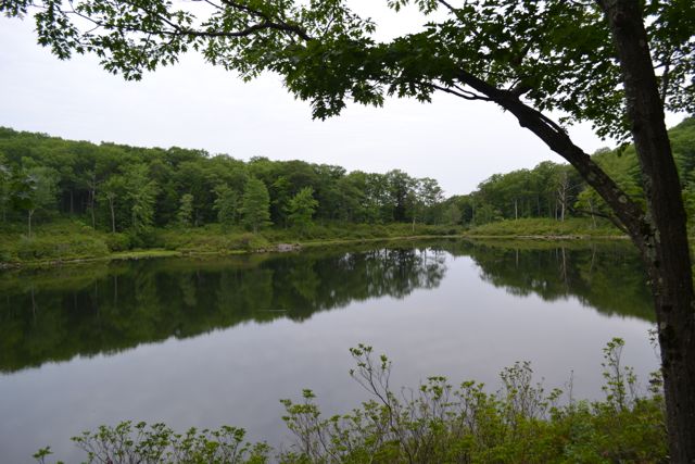
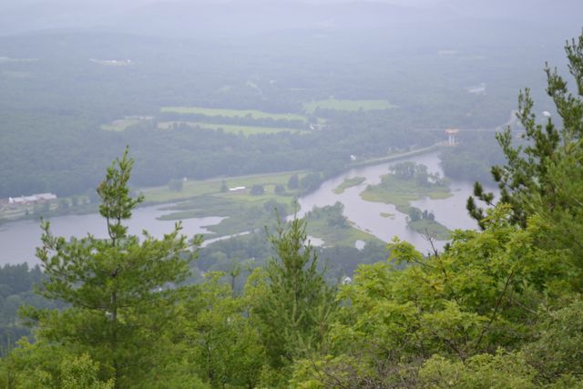
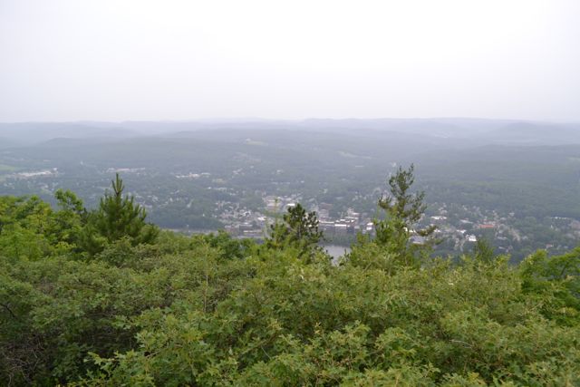
Located just outside of the Forest Society's Madame Sherri Forest, a ledge viewpoint on Wantastiquet Mountain provides a unique vista of Brattleboro, Vermont. On the way, you will wander through the peaceful forests of the preserve, visiting picturesque Indian Pond and the striking Mine Ledge. The Forest Society's Madame Sherri Forest encompasses an area of scenic woodlands centered around Indian Pond. This enjoyable loop hike visits several viewpoints and the pond. The Ann Stokes Loop begins at a small marsh, crosses a bridge, and immediately forks. Here, turn right on a short spur to see the ruins of Madame Sherri's castle (read about the castle's history on the Forest Society's website). Among the ruins are a stone floor and a staircase above a set of arches. The main trail turns left to continue beside the long marsh. The marsh soon ends, and the path leads away. At 0.2 miles, bear right onto the west branch of Ann Stokes Loop. It follows a brook 0.4 uphill to a trail junction near Indian Pond. Bear right onto Mine Ledge Trail, then turn left onto a spur path to the best viewpoint of Indian Pond.
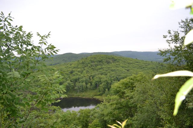
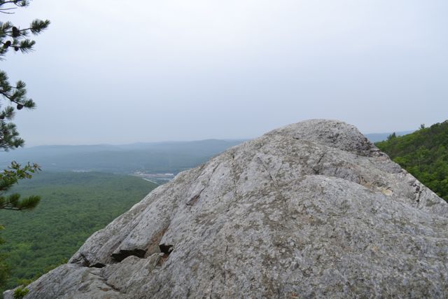
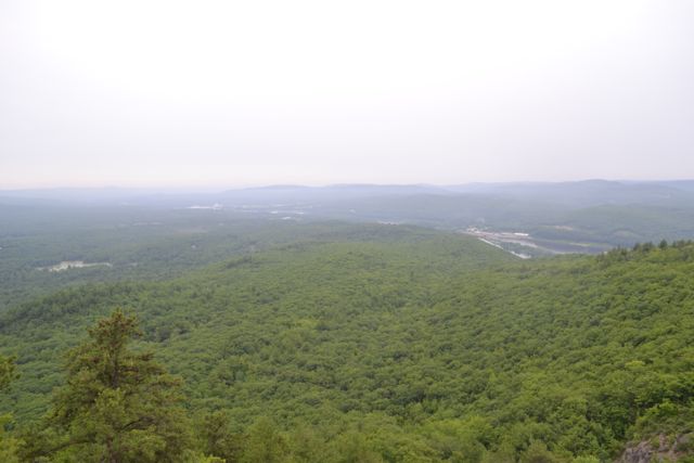
After enjoying the pond from the bottom, continue up the trail to a ledge to view it from above. After a short, steep climb, the trail, now a bit overgrown, leads across a long ridge, reaching a trail junction after 0.7 miles. Bear left onto a spur path to Mine Ledge. This path leads along the top of a precarious cliff and out to the dramatic end of the ledge, with views out into Massachusetts and Pisgah State Park and talus fields straight below. This viewpoint rivals Wantastiquet's and is a fine place to spend some time. The main trail then drops moderately through the lush forest into a small dip before climbing to the actual summit of the mountain, at a communications tower. This is 0.4 miles from Mine Ledge. Here, cross the clearing and continue onto the woods road, which leads to the main viewpoint, on the left, in 0.1 miles. Here, from a blueberry bush filled ledge, there is a close-up directional view of the Connecticut River and the city of Brattleboro.
Printable directions page